South Yuba River State Park Hike and Exploration 1-12-12
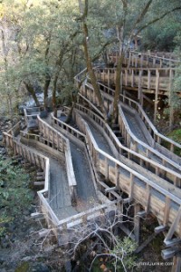
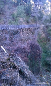
After a week of moving furniture and being stuck inside it was time for an adventure. I consulted one of my guidebooks looking for a new local trail. I settled on the Independence Trail in South Yuba River State Park. There was plenty of history here, and an option to add miles to the hike if I felt good. The trail itself had its origins as the Excelsior Canal, built in 1859 to carry water from the South Yuba to hydraulic gold mining operations in Smartsville, 25 miles away. The hike is very level and shaded. The trail follows the route of the original canal, and the flumes that carried the water over inaccessible terrain have been rebuilt. It is all quite impressive!
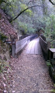
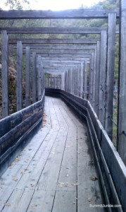
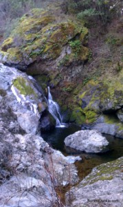
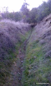
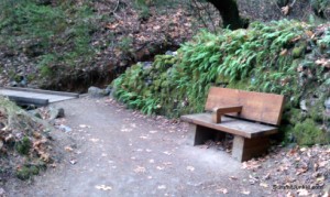
I started my hike on the western trail, heading downstream. The trail crosses multiple flumes before coming to an access ramp leading to a nice waterfall and pool. The trail up to this point is wheelchair accessible, benches and picnic tables are also very common. After about 2 miles the trail narrows and becomes a single track following the old canal route. It is mind boggling to think about the amount of work that went into digging this canal.
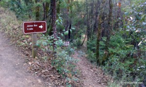
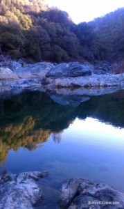
There is a spur trail leading to a river access point at Jones Bar shortly after starting on your trip. This trail is .4 miles long and a bit steep, but well worth the trip. The river pools nicely here with plenty of fishing and swimming options.
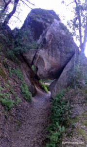
After returning to the parking area I set off on the eastern trail. I found much of the same on this trail. There is a really neat rock feature a short way down the trail offering the chance to walk under a giant boulder!
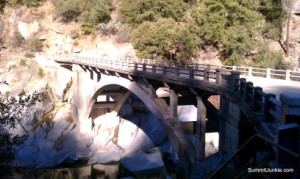
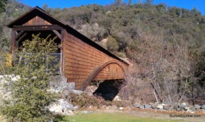
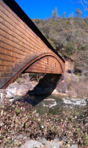
I followed Hwy 49 to the Yuba River crossing and walked out onto the old Hwy bridge. The bridge is very similar to the Rainbow Bridge in Folsom. The bridge was completed in 1922 and was taken out of service in 1993. I continued on to the town of Bridgeport to see the famous covered bridge. At 229 feet the bridge is the longest single-span covered bridge in the world. The Great Republic of Rough and Ready was my last stop of the day.
The total stats for my hike were:
10.5 miles
1,804 Feet of climbing
10.5 miles
1,804 Feet of climbing
I stopped in at the Rough and Ready Country Store for a tasty but slightly over priced sandwich, what a cool store and wonderful people! I took my sandwich out to the Rough and Ready Cemetery and checked out the grave markers dating back to the 1860's.